
Wind measurements by ESA Aeolus space-borne Doppler lidar
are validated by its ground-based predecessor
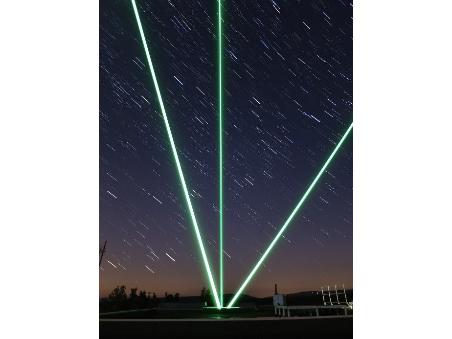
Laser beams of the OHP Doppler wind lidar (north, east and zenith lines-of-sight),
10-minute camera exposure time. Photo by S. Khaykin
Pioneering lidar measurements of wind profile in the middle atmosphere were conducted in Observatoire de Haute-Provence (OHP) by Chanin et al. (1988) using double-edge interferometry. Further improvements of this technique have fostered European Space Agency to face the challenge of developing a space-based Aeolus wind lidar, which was built by Airbus and successfully put into sun-synchronous orbit in August 2018. This frontier space mission based on cutting-edge technologies has a unique capacity of global wind profiling up to 24 km altitude using both particulate and molecular returns, which is not possible with any techniques rather than HSRL (High Spectral Resolution Lidar). The validation of Aeolus wind measurements is currently underway and makes use of various measurement techniques. The OHP wind lidar has recently underwent a major upgrade and now actively contributes to the Aeolus cal/val programme. An article by Khaykin et al. (2020) published in the journal of Atmospheric Measurement Technics provides the first results of Aeolus validation using OHP wind lidar, the predecessor of Aeolus. A remarkable agreement between the ground-based and satellite measurements of wind demonstrates a high level of maturity of this technique that Airbus and LATMOS have shared. Aeolus data are now operationally assimilated by the Integrated Forecast System of ECMWF, which leads to an important improvement of the weather forecast skills (ESA, 2020). At the same time, the global-coverage wind profiling enables new studied of atmospheric dynamics. ESA Aeolus mission has opened new horizons and LATMOS will continue to work actively on this unique data to help paving the way to future fleet of operational wind lidars in space. In Europe, the coordination of a new ground-based infrastructure is proposed within the H2020 ARISE project conceived to advance the European observation and modeling system.
Chanin, M. L., Garnier, A., Hauchecorne, A., and Porteneuve, J.: A Doppler lidar for measuring winds in the middle atmosphere, Geopys. Res. Lett., 16, 1273–1276, https://doi.org/10.1029/GL016i011p01273, 1989.
Khaykin, S. M., Hauchecorne, A., Wing, R., Keckhut, P., Godin-Beekmann, S., Porteneuve, J., Mariscal, J.-F., and Schmitt, J.: Doppler lidar at Observatoire de Haute-Provence for wind profiling up to 75 km altitude: performance evaluation and observations, Atmos. Meas. Tech., 13, 1501–1516, https://doi.org/10.5194/amt-13-1501-2020, 2020
ESA news, 10.01.2020, last access 01.04.2020
https://www.esa.int/Applications/Observing_the_Earth/Aeolus/Aeolus_winds_now_in_daily_weather_forecasts
